
Ready-to-use data
Delivery in Excel, CSV or directly into ArcGIS, Greenpoint and other geospatial tools.
A complete inventory of all road markings or a targeted survey of damaged markings. We map visibility, wear, damage, type and material at object level as a basis for road safety and planned maintenance.
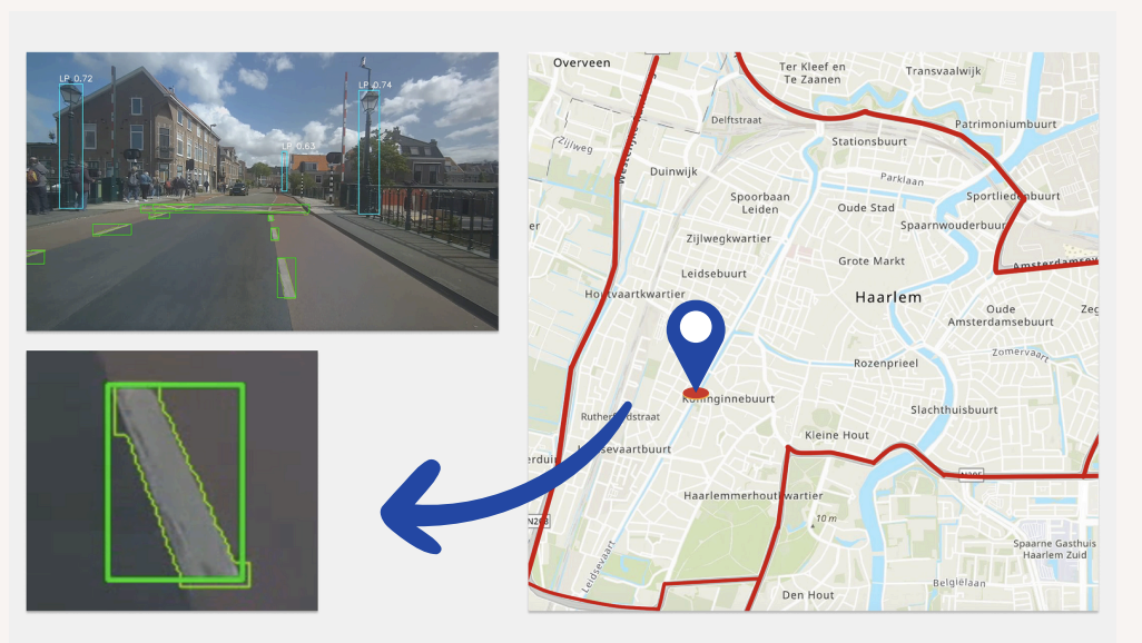
Our AI identifies road markings and assesses visibility, wear and damage for each asset. We also record the marking type, material and severity according to the CROW classification.
Clients can choose a complete inventory of every marking in an area or a targeted survey of damaged and missing markings only.
Visibility
Wear
Damage
Missing marking
Marking type
Material
CROW class
Surface area
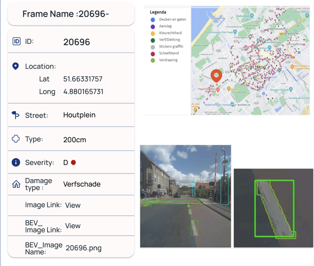
Contractors see exactly where a damaged or missing marking is located, its type and material, and the severity of the damage. They can mark repairs as complete, update the asset status and add a new photograph in the same environment.
Current object-level insight into missing and damaged markings—essential for road safety.
Results are delivered in Excel, CSV or directly into geospatial tools such as ArcGIS, QGIS, GeoVisia and Greenpoint. Analysis, prioritisation and implementation are therefore based on one current dataset containing locations, asset characteristics, CROW assessments and visual evidence.
Depending on the client’s requirements, we can deliver at different levels:
Delivery in Excel, CSV or directly into ArcGIS, Greenpoint and other geospatial tools.
Every marking is linked to its exact location, type and material.
Every asset includes the original high-resolution image and a bird’s-eye-view image.
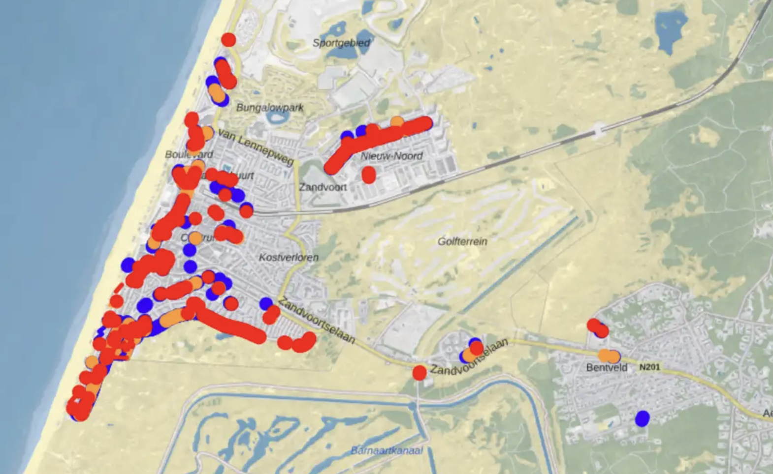
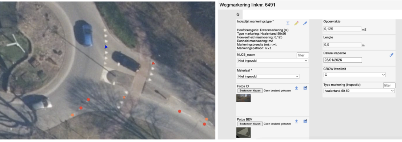
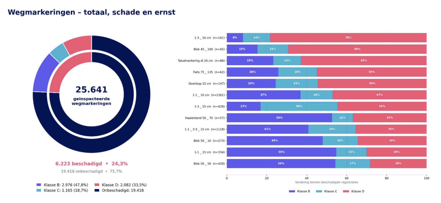
Current asset data enables maintenance teams to intervene precisely and cost-effectively. Work becomes more predictable, budgets more targeted and repaired markings can be updated immediately.

“Repeated lighting inspections across tunnels and cycle paths help keep Rotterdam safe.”
“With current data from Velotech, we stay ahead of public reports and maintain control of our assets.”

“Velotech provides a complete and reliable overview with integrated visual evidence for every asset.”





Book a demo and discover how we survey road markings and deliver the results in a format that fits your asset management system.